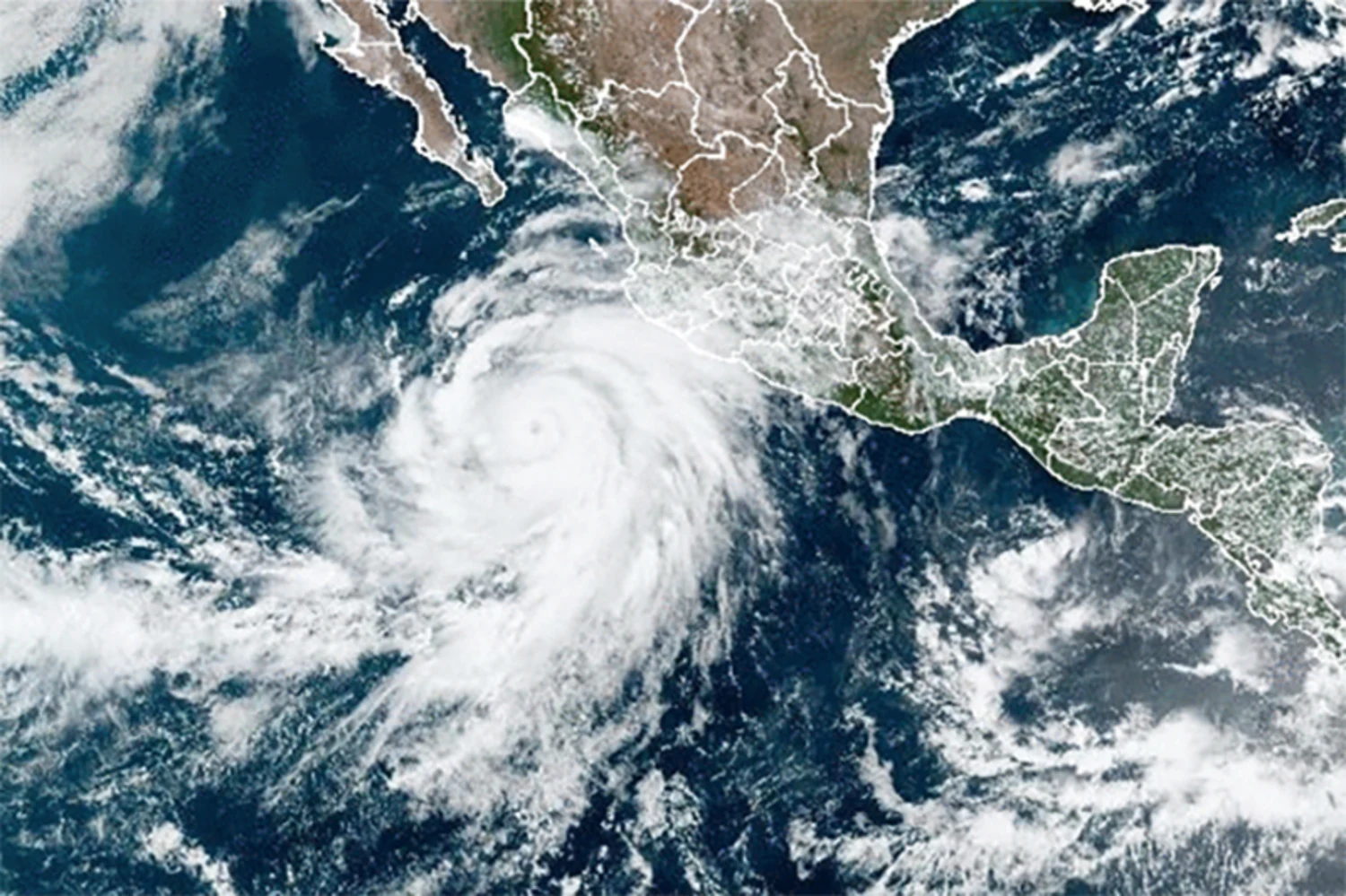
It looks like Hurricane season has finally really begun. Coastal states and countries including Costa Rica and bracing for what could be a big season.
Current Hurricane Status
Category 4 Hurricane Hilary is on course to potentially make its first direct tropical storm strike on Southern California since 1939. As of Friday, 8 am ET, its peak winds were recorded at a staggering 145 mph, situated approximately 400 miles south of Cabo San Lucas, Mexico, and moving at a speed of 13 mph west-northwest.
Forecast Predictions
- Regions may experience rainfall equivalent to multiple years in merely 1-3 days. Deserts areas are particularly at risk of severe flash floods.
- The storm’s trajectory indicates a northern shift with increased speed over the next 24-36 hours.
- By Saturday, as it engages with cooler ocean waters, a weakening phase is anticipated. However, its fast-paced movement might restrict this weakening.

Emerging Weather Anomalies: Impact and Consequences
A unique and rather unusual weather pattern, influenced by human-induced climate change, is taking shape. This will drive the storm, albeit in a weakened state, swiftly north into the generally arid Southwest in the coming four days.
- Areas from San Diego to Los Angeles are under threat of intense rain, fierce winds, and large waves causing beach erosion. These conditions are predicted to intensify from late Saturday, peaking on Sunday and Monday.
- The National Hurricane Center forecasts that by the time Hilary reaches Southern California, it might still produce tropical-storm-force winds.
- Meteorological records could be broken if tropical storm watches are activated for southern California.
- Data from Maxar WeatherDesk indicates downtown Los Angeles hasn’t experienced over 2 inches of summer rain since 1877, underscoring the unprecedented nature of this event.
Understanding the Main Threats
Water is the primary menace posed by Hurricane Hilary. The hurricane center is highlighting concerns of flash, urban, and arroyo flooding along with potential significant impacts.
- A vast region spanning San Diego to Las Vegas is marked under “moderate risk” for excessive rainfall by the Weather Prediction Center. The mountainous zones of San Diego County are categorized under “high risk.”
- Human-induced climate change is intensifying extreme rainfall events. Consequently, tropical storms and hurricanes carry more moisture, leading to increased rainfall.
Numerical Insights
- Forecasts estimate a rain volume of 2-to-10-inches or more across Southern California, extending into adjacent states.
- Flash flood alerts are activated for approximately 26 million individuals across four states: California, Utah, Nevada, and Arizona.
- An astounding surge of 75 mph in 24 hours from Thursday to Friday in maximum sustained winds was recorded. Recent trends indicate increasingly rapid intensification of such storms, a phenomenon linked to human-driven climate change.
The Bigger Climate Picture
The meteorological scenario propelling Hilary into the Southwest includes a massive heat dome enveloping the Central U.S. and a low-pressure zone nearing the Central California coast.
- This heat dome, intensified by climate change, will cause peak summer temperatures for millions across areas from Texas to Iowa, and direct Hilary towards Southern California.
- Extreme weather events are often spurred by anomalous weather patterns.
- Upper-level wind flows between the heat dome and other Pacific Ocean weather systems will navigate Hurricane Hilary at an extraordinarily fast pace, preventing significant weakening upon its approach to California.

