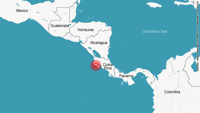
Costa Rica News – On September 5th, 2012, a plate of the Earth’s crust slid beneath another plate twenty five miles underneath the surface of Nicoya, Costa Rica, causing a magnitude 7.6 earthquake. But unlike many other quakes, this one was not entirely a surprise.
 Earthquakes of size seven or even higher have actually taken place at this plate interface in 1853, 1900 and 1953. Once the 1990s came around, experts knew that they should anticipate another at some point during the coming years. They started researching the region using ground-based global positioning system as well as seismic data, which in turn resulted in precise forecasts concerning where a quake was expected to happen and that the earthquake would probably achieve up to a magnitude of 7.8.
The fault where in fact the earthquake took place is what’s referred to as a subduction zone, where exactly 1 plate slips below another. The motion of the plates creates the Earth itself to alter, permitting the group of researchers to trace land movement and additionally determine regions of increasing tension which will ultimately be released within an earthquake, Andrew Newman, a Georgia Institute of Technology associate professor and one author of a new study detailing the research, told weather.com. The plates are in a state seismologists call “locked up.”
“Where that fault locked up starts to build energy for future earthquakes, but what it also tends to do is deform the land,” Newman said. “So we used the deformation of the land to map out the area that’s locked up.”
The Nicoya Peninsula is geologically unusual for the reason that a bulk of subduction areas — in excess of 90%, Newman stated — aren’t beneath land, but rather under water, such as the Cascadia zone off the Pacific Northwest of the United States or the Tohoku region of Japan, where a massive magnitude 9 earthquake triggered a devastating tsunami in March 2011. Cascadia “is capable of unleashing a similarly sized quake,” according to a media release.
Newman desires to carry on researching the Nicoya Peninsula’s reaction to the 2012 quake, which could enable seismologists to far better know how energy accumulates once again after an earthquake. The study really helps to show the necessity of acquiring this type of data in learning about where large earthquakes might strike next, he said. “All we need to do is make detailed images of how the Earth is deforming in subduction zones underwater,” he added, “and we can really start mapping out the areas that are building up energy for release in future earthquakes.”
The investigation was published in the journal Nature Geoscience.

